
MyTopo
Classic USGS Artesia Mississippi 7.5'x7.5' Topo Map
Couldn't load pickup availability
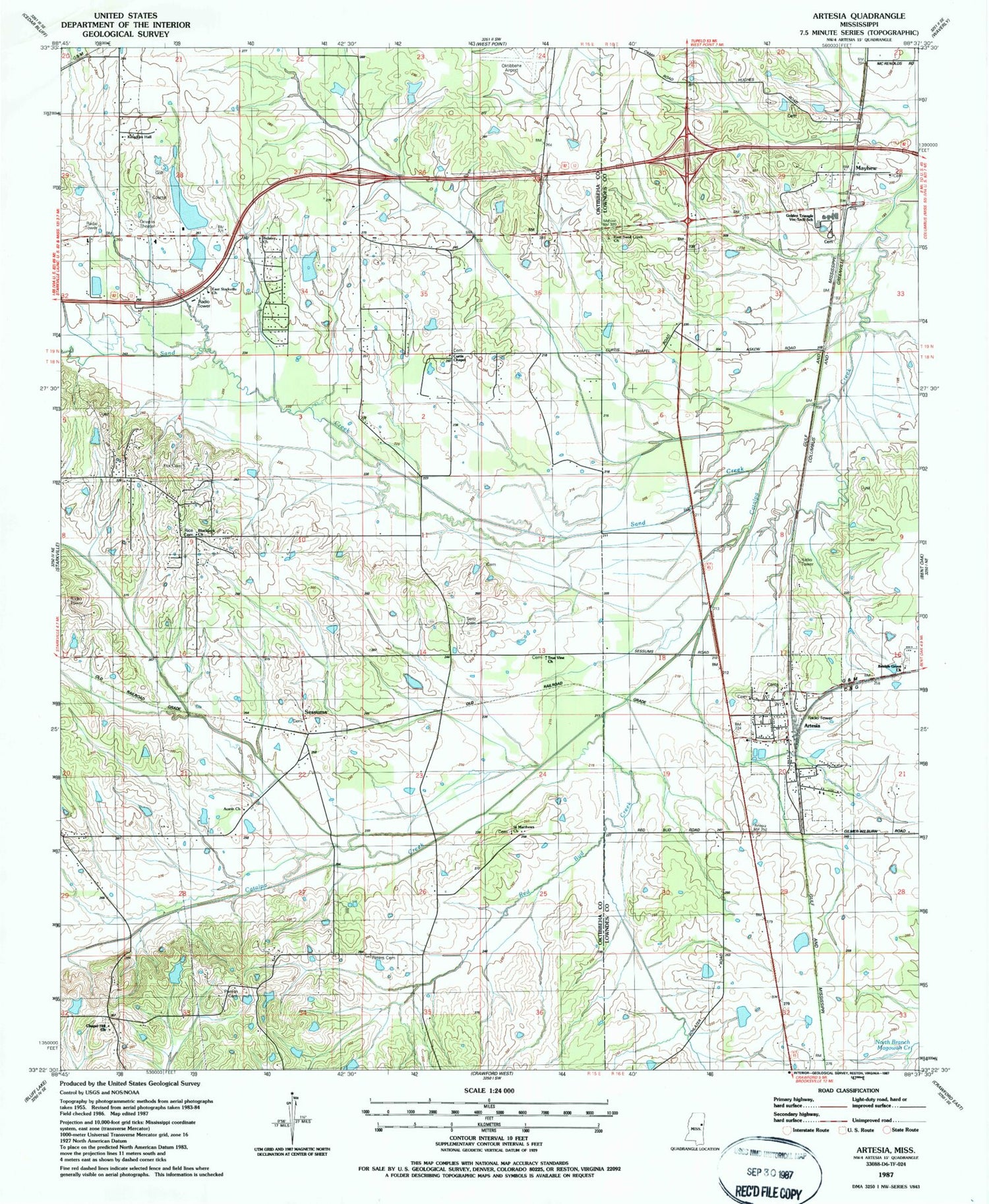
Historical USGS topographic quad map of Artesia in the state of Mississippi. Map scale may vary for some years, but is generally around 1:24,000. Print size is approximately 24" x 27"
This quadrangle is in the following counties: Lowndes, Oktibbeha.
The map contains contour lines, roads, rivers, towns, and lakes. Printed on high-quality waterproof paper with UV fade-resistant inks, and shipped rolled.
Contains the following named places: Artesia, Artesia Post Office, Austin Church of Christ Holiness, Austin School, Belaire Church, Belaire Estates, Beulah Grove Church, Black Jack, Blackjack Missionary Baptist Church, Blackjack School, Bush Crossing, Chapel Hill Baptist Church, Chapel Hill School, Chittobochiah Creek, Crain Lake Dam, Curtis Chapel, Curtis Chapel Cemetery, Davis Lake Dam, East Oktibbeha Volunteer Fire Department Belaire Station, East Oktibbeha Volunteer Fire Department Sessums Station, East Sand Creek Church, East Starkville Church, Fox Cemetery, Golden Triangle Vocational Technical School, Gordon Lake Dam, Hickory Grove, Hickory Grove Estates, Johnson Lake Dam, Jones Lake Dam, Kingdom Hall, Lowndes County District 5 Volunteer Fire and Rescue Department - Artesia Station, Lumis Church, Massey Lake Dam, Mayhew, Mayhew Cemetery, Mississippi No Name 116 Dam, Norris Lake Dam, Parish Lake Dam, Parrish Cemetery, Peters Cemetery, Red Acre, Red Bud Creek, Rice Cemetery, Saint Matthews Church, Saint Matthews School, Sand Creek, Sand Creek Cemetery, Seitz Cemetery, Sessums, Sessums Cemetery, Sessums Methodist Church, Supervisor District 2, Town of Artesia, True Vine Church, Truevine School, White Lake Dam, WKOR-AM (Starkville), Wolfe Creek, ZIP Codes: 39736, 39760


