
MyTopo
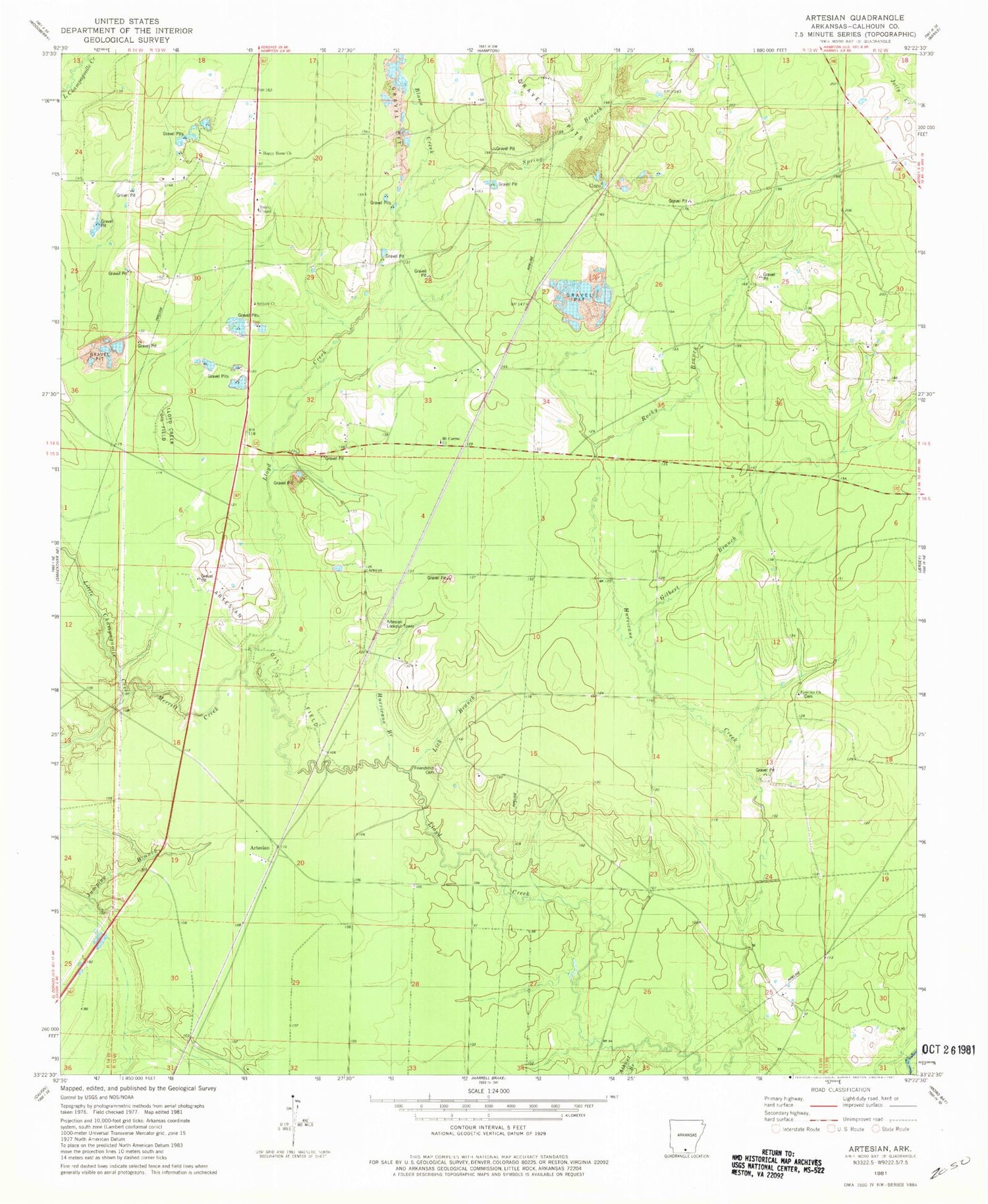
Classic USGS Artesian Arkansas 7.5'x7.5' Topo Map
Couldn't load pickup availability
Historical USGS topographic quad map of Artesian in the state of Arkansas. Map scale may vary for some years, but is generally around 1:24,000. Print size is approximately 24" x 27"
This quadrangle is in the following counties: Bradley, Calhoun.
The map contains contour lines, roads, rivers, towns, and lakes. Printed on high-quality waterproof paper with UV fade-resistant inks, and shipped rolled.
Contains the following named places: Antioch Church, Artesian, Artesian Lookout Tower, Artesian Oil Field, Athant Branch, Bangs Slough, Blann Creek, Blann School, Faustina Cemetery, Faustina Church, Friendship Cemetery, Gilbert Branch, Happy Home Church, Hurricane Branch, Jumping Branch, Lick Branch, Lloyd Creek Oil Field, Merritt Creek, Mount Carmel Church, Rocky Branch, Spring Branch, Township 4, Township 5, Township of Franklin, Trinity Chapel, Unco, ZIP Code: 71744


