MyTopo
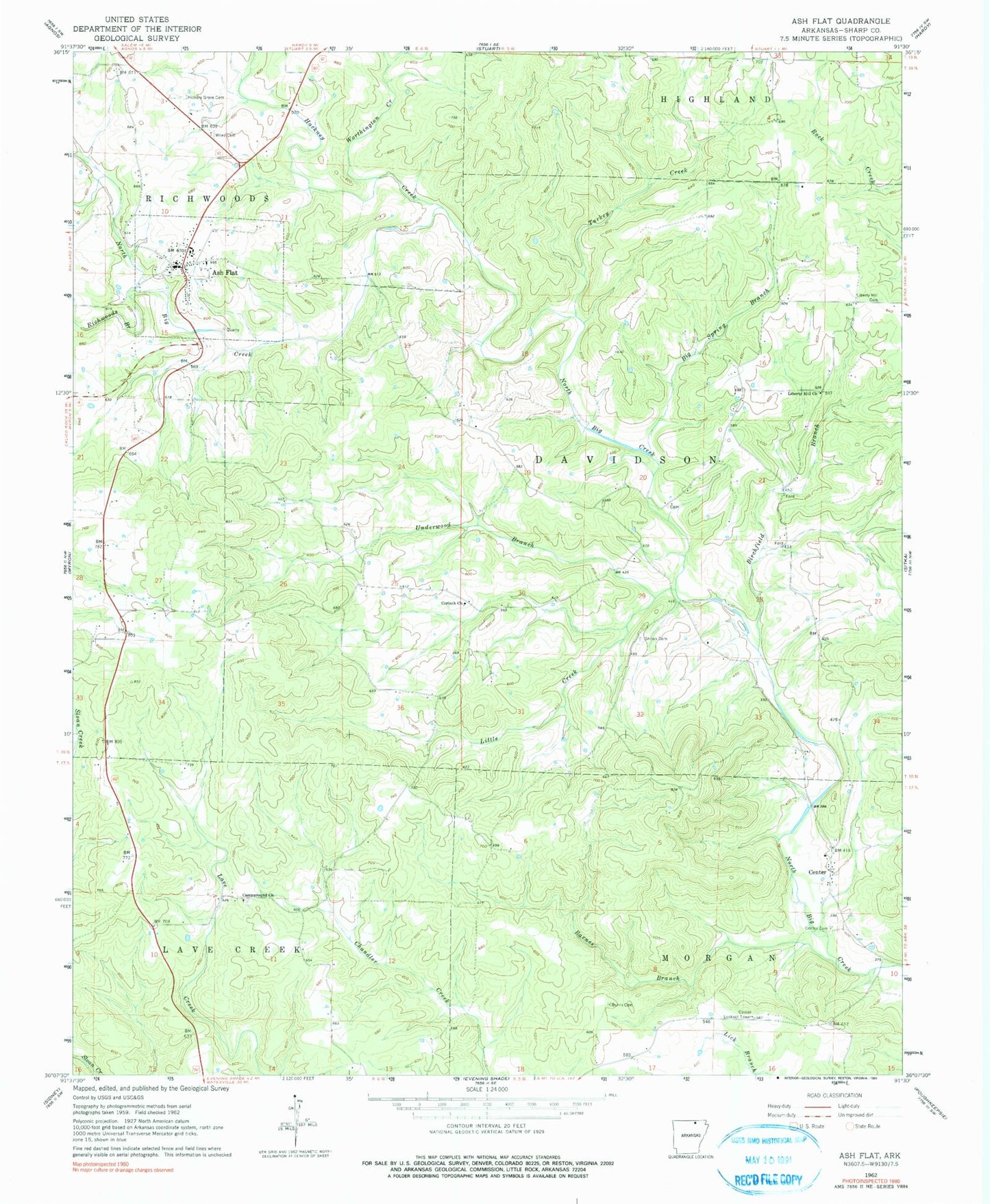
Classic USGS Ash Flat Arkansas 7.5'x7.5' Topo Map
Couldn't load pickup availability
Historical USGS topographic quad map of Ash Flat in the state of Arkansas. Map scale may vary for some years, but is generally around 1:24,000. Print size is approximately 24" x 27"
This quadrangle is in the following counties: Fulton, Sharp.
The map contains contour lines, roads, rivers, towns, and lakes. Printed on high-quality waterproof paper with UV fade-resistant inks, and shipped rolled.
Contains the following named places: Ash Flat, Ash Flat Police Department, Ash Flat Post Office, Ash Flat Volunteer Fire Department, Barnes Branch, Big Spring Branch, Birchfield Branch, Burns Cemetery, Campground Church, Center, Center Cemetery, Center Lookout Tower, Center Rural Fire Department, City of Ash Flat, Corinth United Methodist Church, Hackney Creek, Kings Mills, Liberty Hill Cemetery, Liberty Hill United Methodist Church, Little Creek, Old Baptist Cemetery, Richwoods Branch, Schales Branch, Sharp County Sheriff's Office, Shiloh Cemetery, Township of Lave Creek, Township of Morgan, Township of Richwoods, Turkey Creek, Underwood Branch, Wiles Cemetery, Worthington Creek