MyTopo
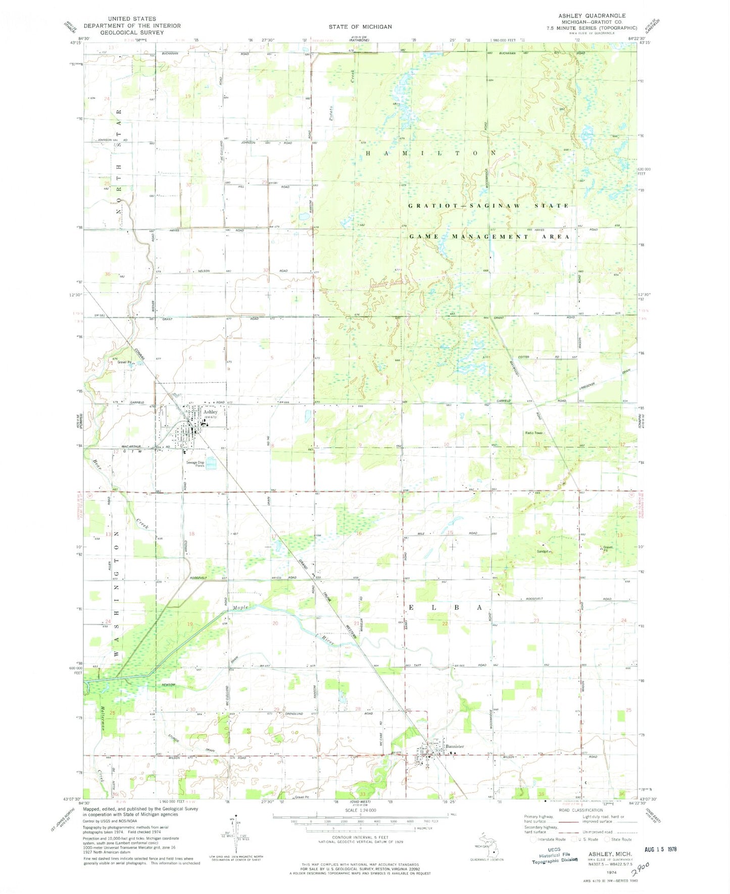
Classic USGS Ashley Michigan 7.5'x7.5' Topo Map
Couldn't load pickup availability
Historical USGS topographic quad map of Ashley in the state of Michigan. Typical map scale is 1:24,000, but may vary for certain years, if available. Print size: 24" x 27"
This quadrangle is in the following counties: Gratiot.
The map contains contour lines, roads, rivers, towns, and lakes. Printed on high-quality waterproof paper with UV fade-resistant inks, and shipped rolled.
Contains the following named places: Ashley, Bannister, Bear Creek, Drain Number One Hundred Forty-two, Halterman Creek, Newsom Drain, Sturgis Drain, Township of Elba, Township of Hamilton, Village of Ashley, Gladwin Cornerstone Baptist Church, Ashley Care Center, Ashley Family Care Center, Ashley Community School, Ashley Post Office, United Methodist Church, Ashley Station, Bannister Station, Bannister United Methodist Church, Saint Cyril's Church, Bannister Post Office, Stella Post Office (historical), Ashley Fire Department, Ashley Rescue Squad, Shady Lawn Field, Kridner Farms