MyTopo
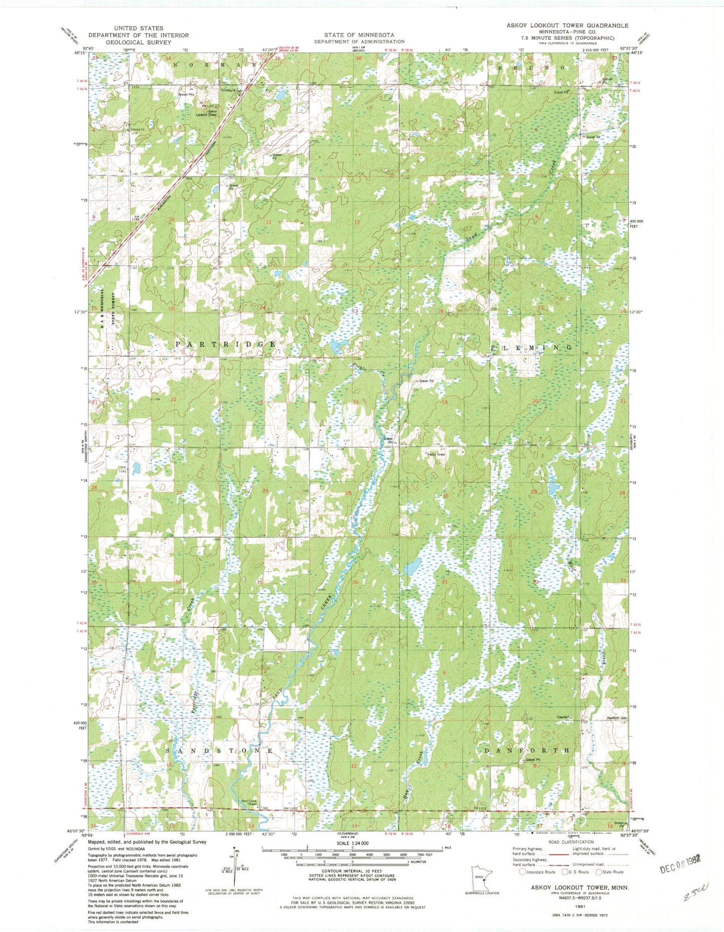
Classic USGS Askov Lookout Tower Minnesota 7.5'x7.5' Topo Map
Regular price
$16.95
Regular price
Sale price
$16.95
Unit price
per
Couldn't load pickup availability
Historical USGS topographic quad map of Askov Lookout Tower in the state of Minnesota. Map scale may vary for some years, but is generally around 1:24,000. Print size is approximately 24" x 27"
This quadrangle is in the following counties: Pine.
The map contains contour lines, roads, rivers, towns, and lakes. Printed on high-quality waterproof paper with UV fade-resistant inks, and shipped rolled.
Contains the following named places: Askov Lookout Tower, Assembly of God Church, D A R Memorial State Forest, Danforth Cemetery, Danforth School, Pickle Creek, Rock Dam Creek, Sand Creek Chapel, Scott Dixon Pond, Scott Dixon Pond Dam, Township of Partridge, Villstad Church, Vilstad Lutheran Cemetery