MyTopo
Classic USGS Assumption Ohio 7.5'x7.5' Topo Map
Couldn't load pickup availability
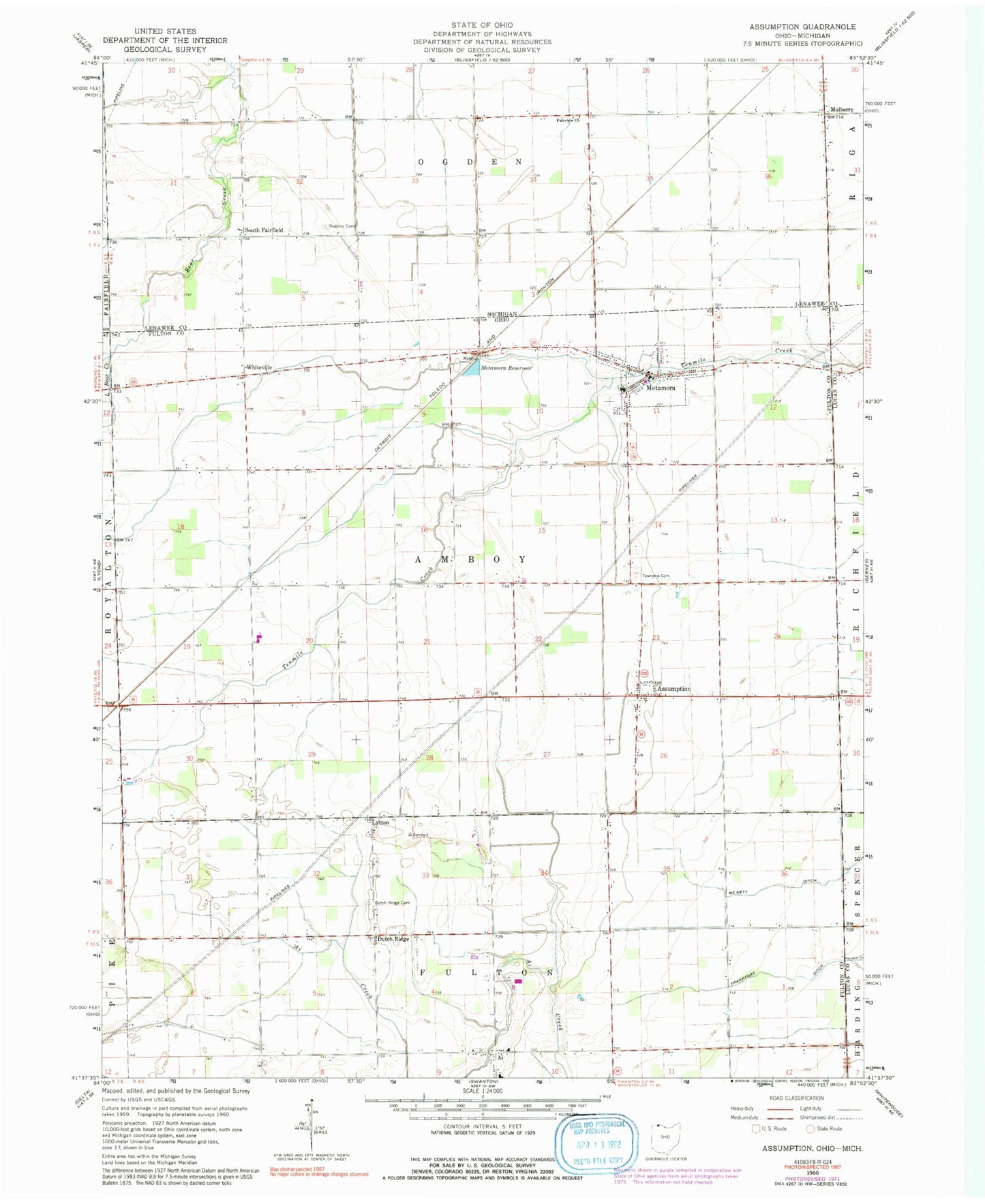
Historical USGS topographic quad map of Assumption in the states of Ohio, Michigan. Map scale may vary for some years, but is generally around 1:24,000. Print size is approximately 24" x 27"
This quadrangle is in the following counties: Fulton, Lenawee, Lucas.
The map contains contour lines, roads, rivers, towns, and lakes. Printed on high-quality waterproof paper with UV fade-resistant inks, and shipped rolled.
Contains the following named places: Ai, Ai Cemetery, Ai Census Designated Place, Ai Post Office, Ai Union Church, Amboy Township Cemetery, Assumption, Beroske Farms and Greenhouse, Blain School, Champion, Dennis School, Dowling Dairy Farms, Dutch Ridge, Dutch Ridge Cemetery, Evergreen High School, Evergreen Middle School, Fairview Church, Faith Lutheran Church, Favorite School, Finnigan School, Fulton Elementary school, Lebanon Evangelical Church, Leslie, Leslie Post Office, Little Bear Creek, Lytton, Lytton Post Office, Lytton Zion United Church of Christ, Metamora, Metamora Amboy Volunteer Fire Department, Metamora Post Office, Metamora Reservoir, Metamora United Methodist Church, Mobes School, Mountain Assembly of God Church, Mulberry, Mulberry Post Office, Nevitt School, Peebles Cemetery, Saint Marys Catholic Cemetery, Saint Marys Catholic Church, School Number 15, Shook School, Siney, Siney Post Office, South Fairfield, South Fairfield Post Office, Special School, Townline, Township of Amboy, Treadway, Tripp School, Village of Metamora, Whiteville, Whiteville Post Office, Wright School, ZIP Code: 43540