MyTopo
Classic USGS Atlanta Mississippi 7.5'x7.5' Topo Map
Couldn't load pickup availability
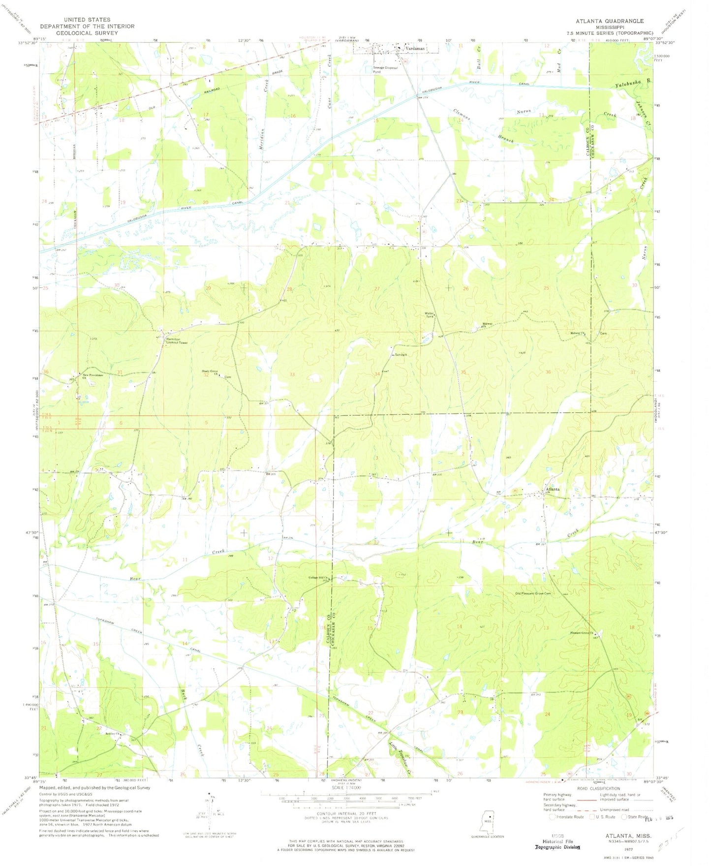
Historical USGS topographic quad map of Atlanta in the state of Mississippi. Map scale may vary for some years, but is generally around 1:24,000. Print size is approximately 24" x 27"
This quadrangle is in the following counties: Calhoun, Chickasaw.
The map contains contour lines, roads, rivers, towns, and lakes. Printed on high-quality waterproof paper with UV fade-resistant inks, and shipped rolled.
Contains the following named places: Atlanta, Atlanta Colored School, Atlanta Methodist Church, Atlanta School, Bentley Church, Bently, Bently Cemetery, Bowles, Buck Creek, Bull Creek, Cane Creek, Clemons Branch, Collage Hill Church, College Hill Church, Erin, Hamilton Lookout Tower, Hollis, Inman Lake Dam, Johnson Creek, Little Topashaw Creek, Meridian Creek, Midway Baptist Church, Midway Cemetery, Midway Church, Mount Zion, Mud Creek, Naron Creek, New Providence Church, Old Pleasant Grove Cemetery, Old Providence Cemetery, Pleasant Grove Baptist Church, Pleasant Grove Cemetery, Providence Cemetery, Rhodes Chapel / Atlanta Volunteer Fire Department Station 2, Shady Grove Church, Supervisor District 5, Tetter Lake Dam, Wade Field