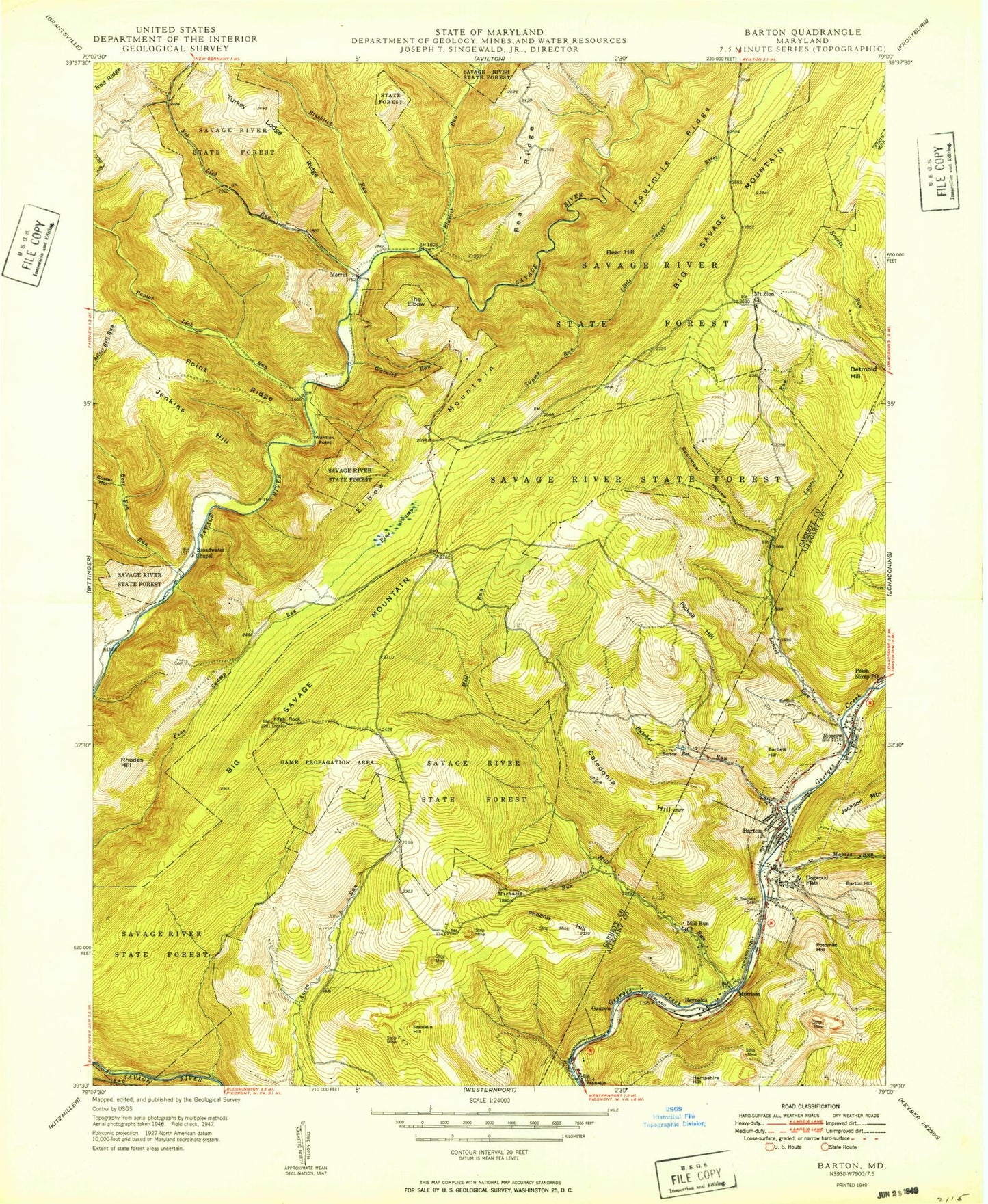
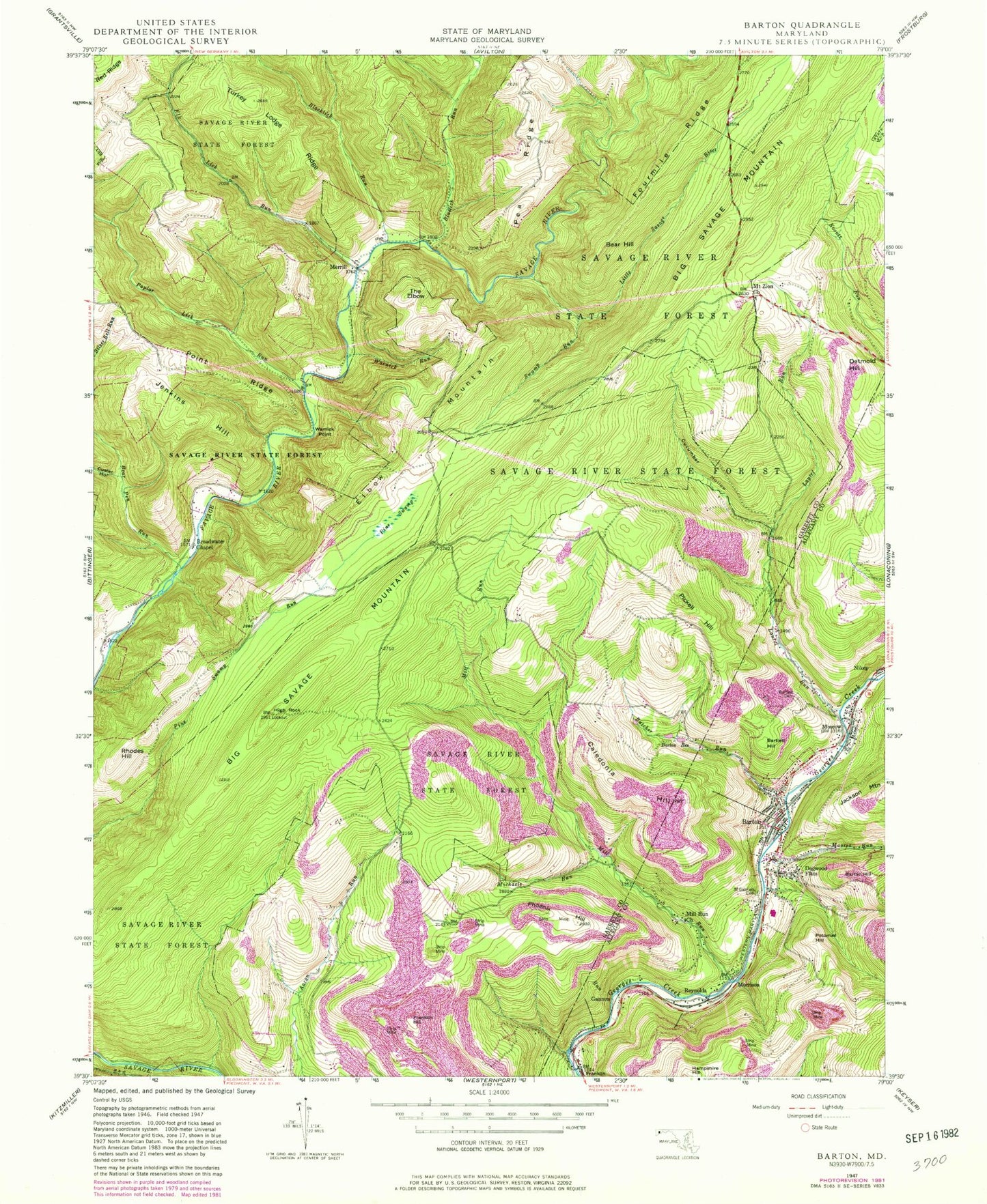
MyTopo
Classic USGS Barton Maryland 7.5'x7.5' Topo Map
Couldn't load pickup availability
Historical USGS topographic quad map of Barton in the state of Maryland. Typical map scale is 1:24,000, but may vary for certain years, if available. Print size: 24" x 27"
This quadrangle is in the following counties: Allegany, Garrett.
The map contains contour lines, roads, rivers, towns, and lakes. Printed on high-quality waterproof paper with UV fade-resistant inks, and shipped rolled.
Contains the following named places: Barlett Cemetery, Barton, Barton Reservation, Bear Pen Run, Blacklick Run, Bluelick Run, Broadwater Chapel, Butcher Run, Cucumber Hollow, Custer Hollow, Elk Lick Run, High Rock, Horse Ridge, Laurel Run, Little Savage River, Michaels Run, Mill Run, Mill Run Church, Moores Run, Moscow, Mount Zion Church, Pine Swamp, Point Ridge, Poplar Lick Run, Saint Gabriels Cemetery, Silver Bell Run, Swamp Run, Turkey Lodge Ridge, Warnick Point, Warnick Run, West Branch Bluelick Run, Merrill, Bartlett Hill, Barton Hill, Bear Hill, Big Savage Mountain, Caledonia Hill, Detmold Hill, Dogwood Flats, Elbow Mountain, Franklin Hill, Gannon, Hampshire Hill, Morrison, Phoenix Hill, Pickell Hill, Potomac Hill, Reynolds, Rhodes Hill, The Elbow, Barton Debris Basin Dam, Barton Debris Basin, Moran Field (historical), Turkey Lodge Hill, Barton Elementary School, Barton Post Office, Morrison Cemetery, Moscow Mills Cemetery, Moscow School (historical), Nikep Post Office, Phoenix (historical), District 11 The Elbow, District 4 Bloomington, District 9 Barton, Piedmont Dam, Piedmon Dam, Barton Hose Company 1, Town of Barton, Moscow Census Designated Place, Barton Police Department