MyTopo
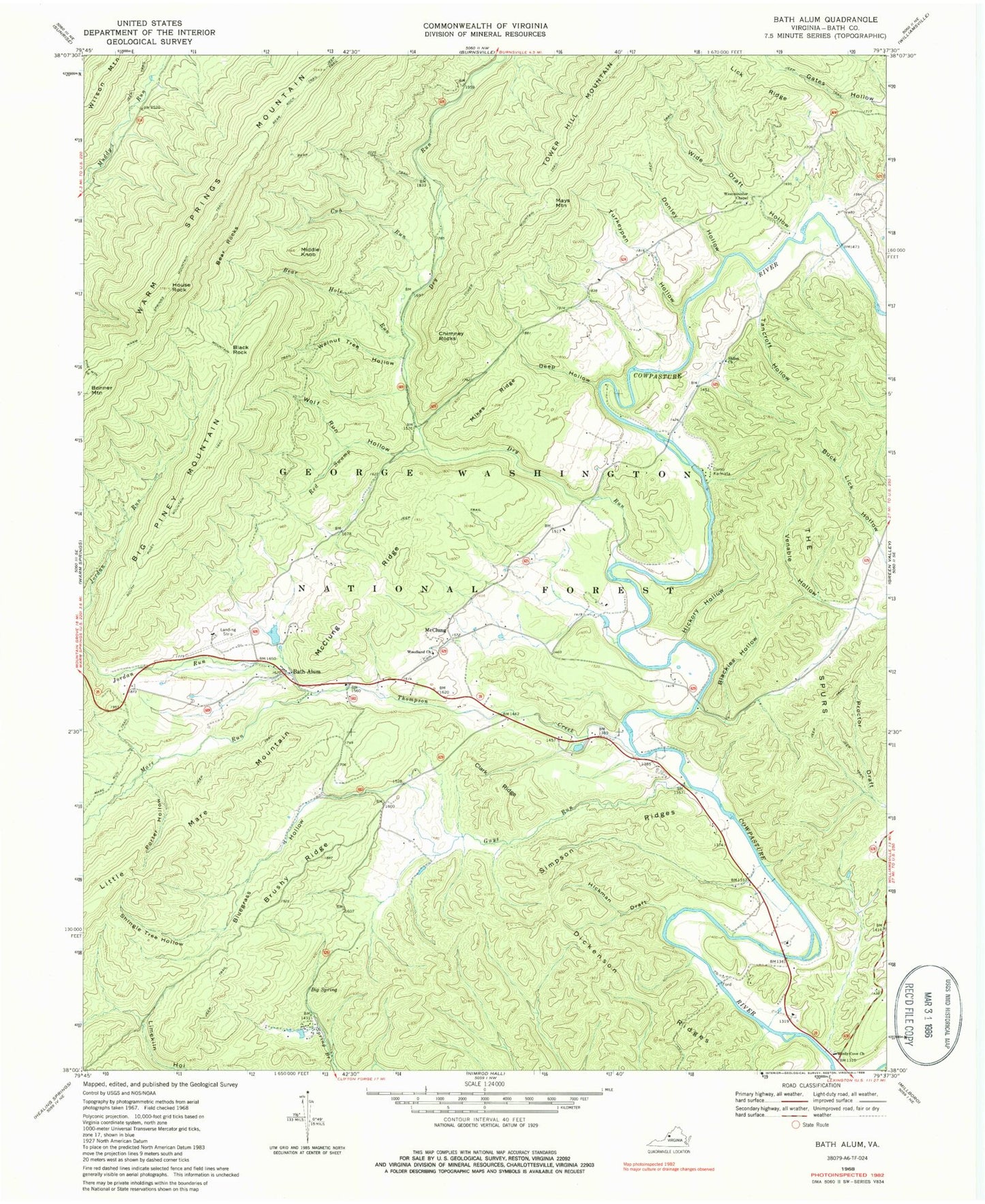
Classic USGS Bath Alum Virginia 7.5'x7.5' Topo Map
Couldn't load pickup availability
Historical USGS topographic quad map of Bath Alum in the state of Virginia. Typical map scale is 1:24,000, but may vary for certain years, if available. Print size: 24" x 27"
This quadrangle is in the following counties: Bath.
The map contains contour lines, roads, rivers, towns, and lakes. Printed on high-quality waterproof paper with UV fade-resistant inks, and shipped rolled.
Contains the following named places: Bath Alum, Bear Hole Run, Bear Rock Trail, Bear Rocks, Big Piney Mountain, Big Spring, Blackies Hollow, Bluegrass Hollow, Brushy Ridge, Camp Kannata, Chimney Rocks, Clark Ridge, Cub Run, Deep Hollow, Dickenson Ridges, Donley Hollow, Dry Run, Guys Run, Hickman Draft, Hickory Hollow, House Rock, Jordan Run, Lick Ridge, Mare Run, McClung, McClung Ridge, Middle Knob, Mikes Ridge, Porter Hollow, Red Swamp, Shiloh United Methodist Church, Shingle Tree Hollow, Simpson Ridges, South Piney Mountain Trail, Tancroft Hollow, The Spurs, Thompson Creek, Turkeypen Hollow, Venable Hollow, Walnut Tree Hollow, Warm Springs Mountain Trail, Westminister Chapel, Wide Draft Hollow, Windy Cove Presbyterian Church, Wolf Run Hollow, Woodland Presbyterian Church, Aviation Golf and Farm Club Dam, Lake of the Pines, Black Rock, Mays Mountain, Bath Alum Airport, Bath Alum Camp (historical), Bath County, Fayette County Hunting and Fishing Club, Shiloh, Williamsville District