MyTopo
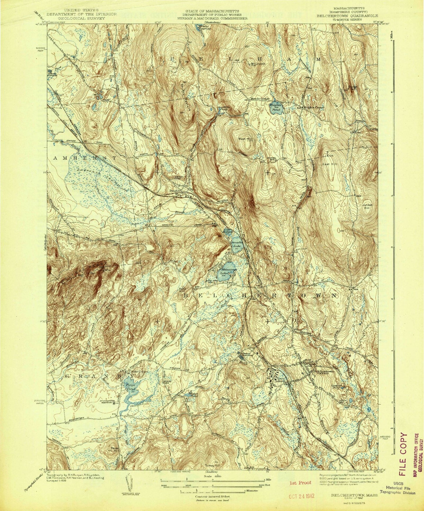
Classic USGS Belchertown Massachusetts 7.5'x7.5' Topo Map
Couldn't load pickup availability
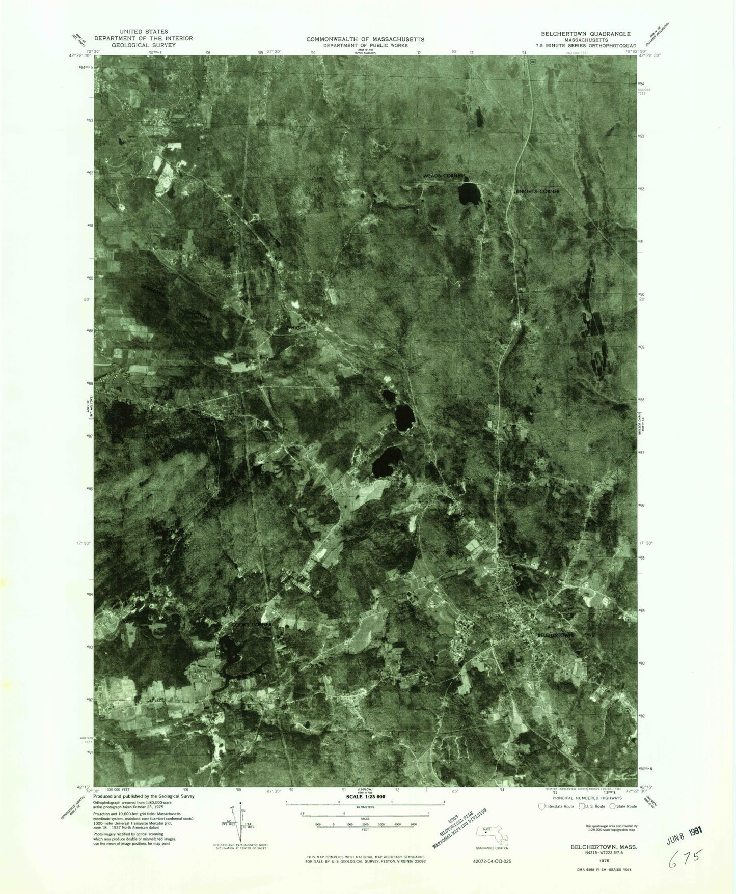
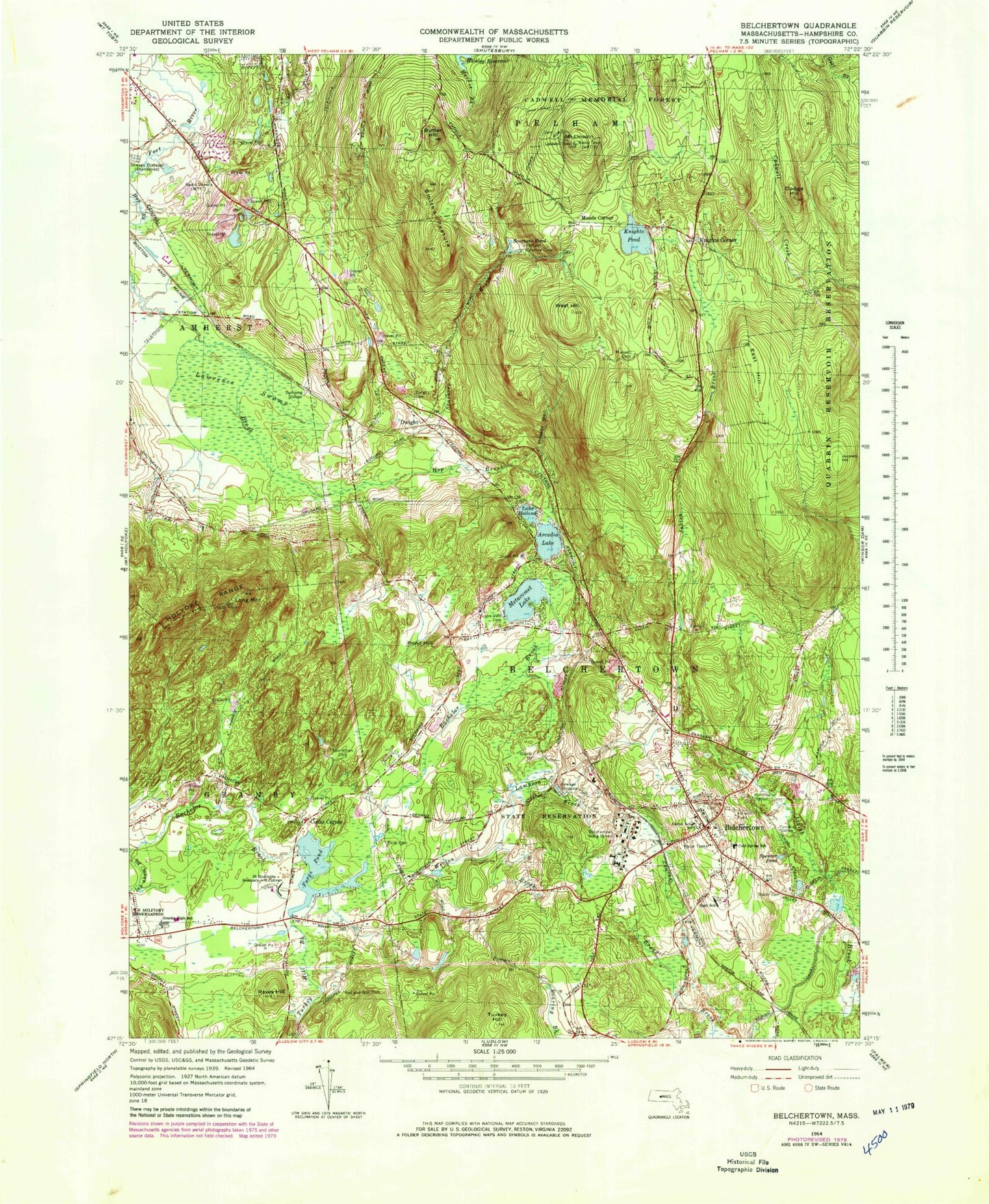
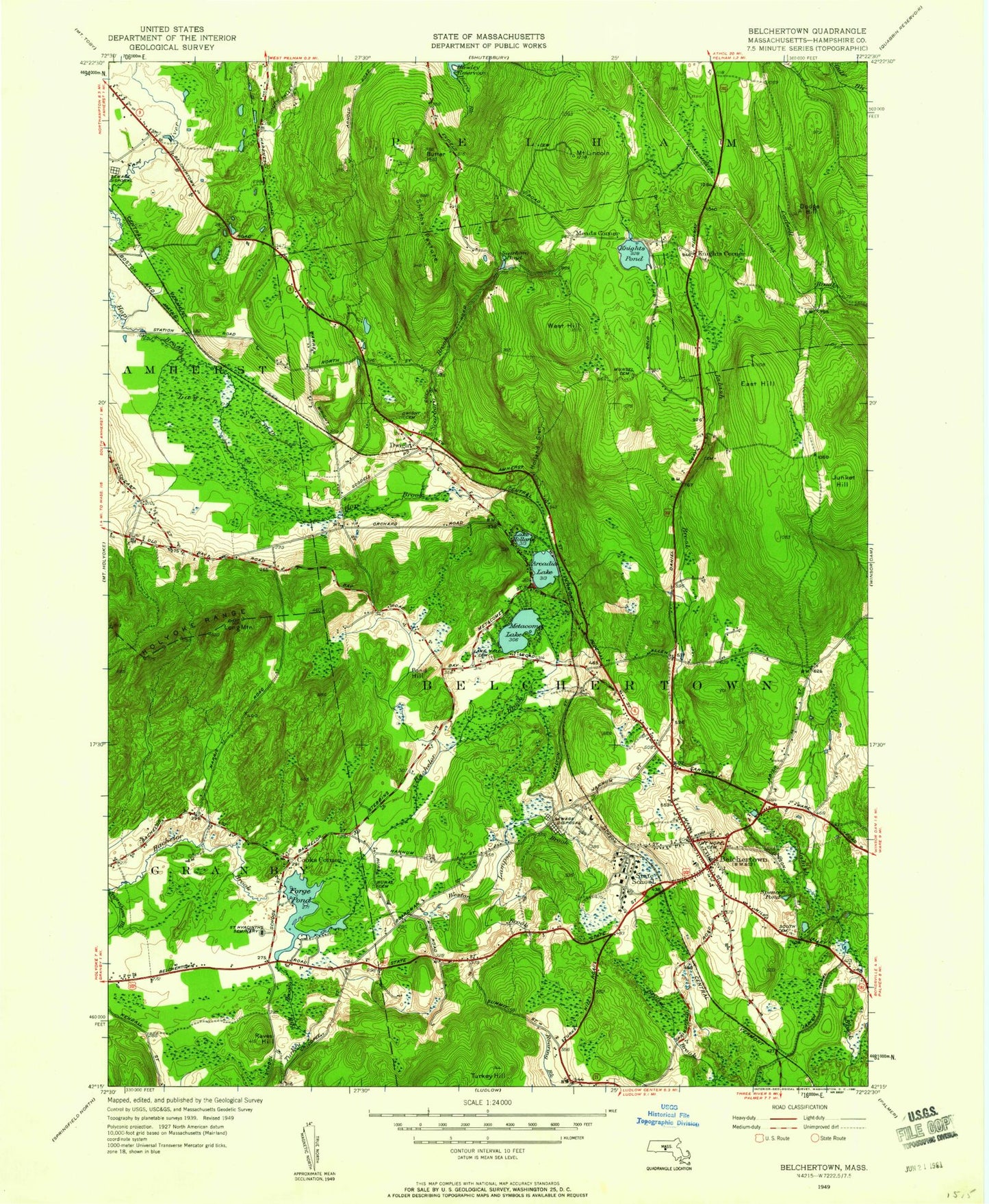
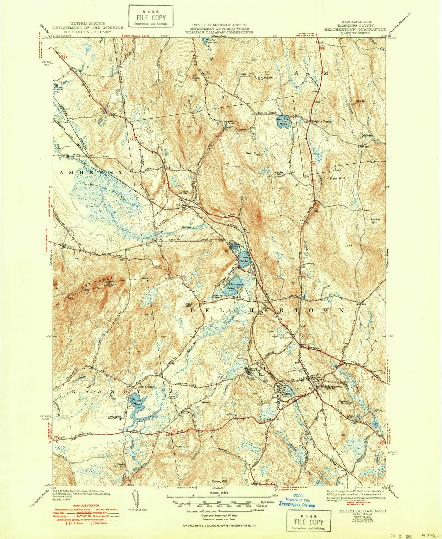
Historical USGS topographic quad map of Belchertown in the state of Massachusetts. Typical map scale is 1:24,000, but may vary for certain years, if available. Print size: 24" x 27"
This quadrangle is in the following counties: Hampshire.
The map contains contour lines, roads, rivers, towns, and lakes. Printed on high-quality waterproof paper with UV fade-resistant inks, and shipped rolled.
Contains the following named places: Jackson Street School, South Cemetery, Munsell Cemetery, Granby Junior-Senior High School, Saint Hyacinths Seminary and College, Cold Spring School, Center School, Lake Vale Cemetery, Pelham Country Club, Dwight Cemetery, Belchertown State School, Sportsman Club, Rod and Gun Club, Belchertown High School, Cadwell Memorial Forest, Mount Hope Cemetery, Bachelor Brook Dam, Forge Pond Dike, Forge Pond Dam, Sportsmen Club Dan, Arcadia Lake, Belchertown, Cooks Corner, Dodge Hill, Dwight, East Hill, Forge Pond, Holland Glen, Lake Holland, Juckett Hill, Knights Corner, Knights Pond, Lampson Brook, Larence Swamp, Mount Lincoln, Long Mountain, Meads Corner, Metacomet Lake, Packardville, Pond Hill, Raves Hill, Scarboro Brook, Scarboro Pond, Smiths Pasture, Spencer Pond, West Hill, Weston Brook, Turkey Hill Brook, Federal S, Town of Belchertown, WTTT-AM (Amherst), WFCR-FM (Amherst), WAMH-FM (Amherst), WRNX-FM (Amherst), B-Town Heliport, Amherst Field Office and Research Park, Belchertown Center Historic District, Belchertown Post Office, Belchertown Town Hall, Christ Life Fellowship Church, Dwight Chapel, Highland Glen Estates, Hope United Methodist Church, Kolbe Memorial Library, South Quabbin Villa, East Meadow School, Grey Rocks, Chestnut Hill Community School Library, Granby Junior-Senior High School Library Media Center, Swift River Elementary School Library, Belchertown Census Designated Place, Norm's Field, Belchertown Fire Department, Belchertown Ambulance Service, Belchertown Police Station, Jackson Street School, South Cemetery, Munsell Cemetery, Granby Junior-Senior High School, Saint Hyacinths Seminary and College, Cold Spring School, Center School, Lake Vale Cemetery, Pelham Country Club, Dwight Cemetery, Belchertown State School, Sportsman Club, Rod and Gun Club, Belchertown High School, Cadwell Memorial Forest, Mount Hope Cemetery, Bachelor Brook Dam, Forge Pond Dike, Forge Pond Dam, Sportsmen Club Dan, Arcadia Lake, Belchertown, Cooks Corner, Dodge Hill, Dwight, East Hill, Forge Pond, Holland Glen, Lake Holland, Juckett Hill, Knights Corner, Knights Pond, Lampson Brook, Larence Swamp, Mount Lincoln, Long Mountain, Meads Corner, Metacomet Lake, Packardville, Pond Hill, Raves Hill, Scarboro Brook, Scarboro Pond, Smiths Pasture, Spencer Pond, West Hill, Weston Brook, Turkey Hill Brook, Federal S, Town of Belchertown, WTTT-AM (Amherst), WFCR-FM (Amherst), WAMH-FM (Amherst), WRNX-FM (Amherst), B-Town Heliport, Amherst Field Office and Research Park, Belchertown Center Historic District, Belchertown Post Office, Belchertown Town Hall, Christ Life Fellowship Church, Dwight Chapel, Highland Glen Estates, Hope United Methodist Church, Kolbe Memorial Library, South Quabbin Villa, East Meadow School, Grey Rocks, Chestnut Hill Community School Library, Granby Junior-Senior High School Library Media Center, Swift River Elementary School Library, Belchertown Census Designated Place, Norm's Field, Belchertown Fire Department, Belchertown Ambulance Service, Belchertown Police Station, Jackson Street School, South Cemetery, Munsell Cemetery, Granby Junior-Senior High School, Saint Hyacinths Seminary and College, Cold Spring School, Center School, Lake Vale Cemetery, Pelham Country Club, Dwight Cemetery, Belchertown State School, Sportsman Club, Rod and Gun Club, Belchertown High School, Cadwell Memorial Forest, Mount Hope Cemetery, Bachelor Brook Dam, Forge Pond Dike, Forge Pond Dam, Sportsmen Club Dan, Arcadia Lake, Belchertown, Cooks Corner, Dodge Hill, Dwight, East Hill, Forge Pond, Holland Glen, Lake Holland, Juckett Hill, Knights Corner, Knights Pond, Lampson Brook, Larence Swamp, Mount Lincoln, Long Mountain, Meads Corner, Metacomet Lake, Packardville, Pond Hill, Raves Hill, Scarboro Brook, Scarboro Pond, Smiths Pasture, Spencer Pond, West Hill, Weston Brook, Turkey Hill Brook, Federal S, Town of Belchertown, WTTT-AM (Amherst), WFCR-FM (Amherst), WAMH-FM (Amherst), WRNX-FM (Amherst), B-Town Heliport, Amherst Field Office and Research Park, Belchertown Center Historic District, Belchertown Post Office, Belchertown Town Hall, Christ Life Fellowship Church, Dwight Chapel, Highland Glen Estates, Hope United Methodist Church, Kolbe Memorial Library, South Quabbin Villa, East Meadow School, Grey Rocks, Chestnut Hill Community School Library, Granby Junior-Senior High School Library Media Center, Swift River Elementary School Library, Belchertown Census Designated Place, Norm's Field, Belchertown Fire Department, Belchertown Ambulance Service, Belchertown Police Station, Jackson Street School, South Cemetery, Munsell Cemetery, Granby Junior-Senior High School, Saint Hyacinths Seminary and College, Cold Spring School, Center School, Lake Vale Cemetery, Pelham Country Club, Dwight Cemetery, Belchertown State School