MyTopo
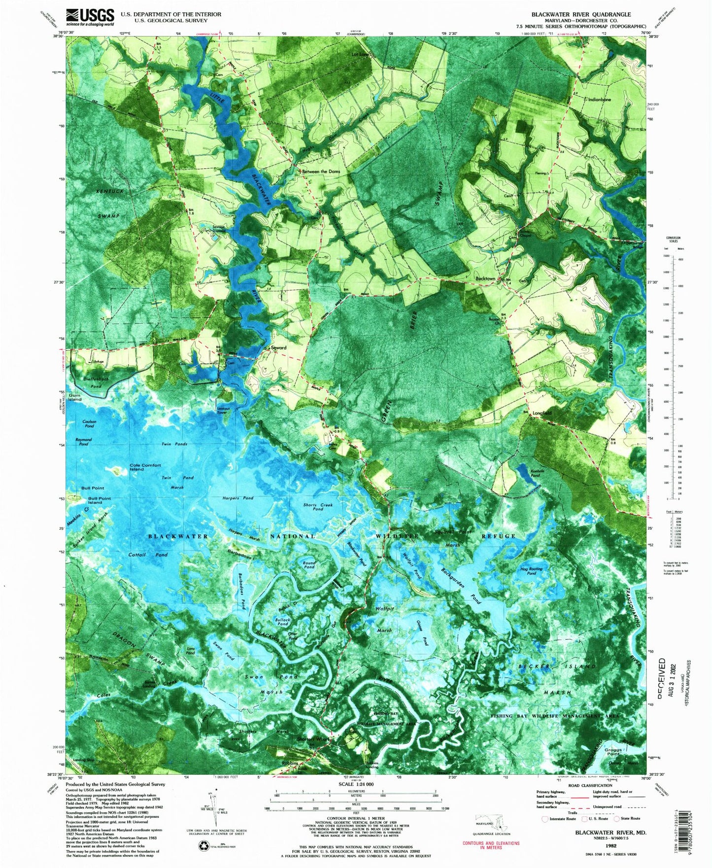
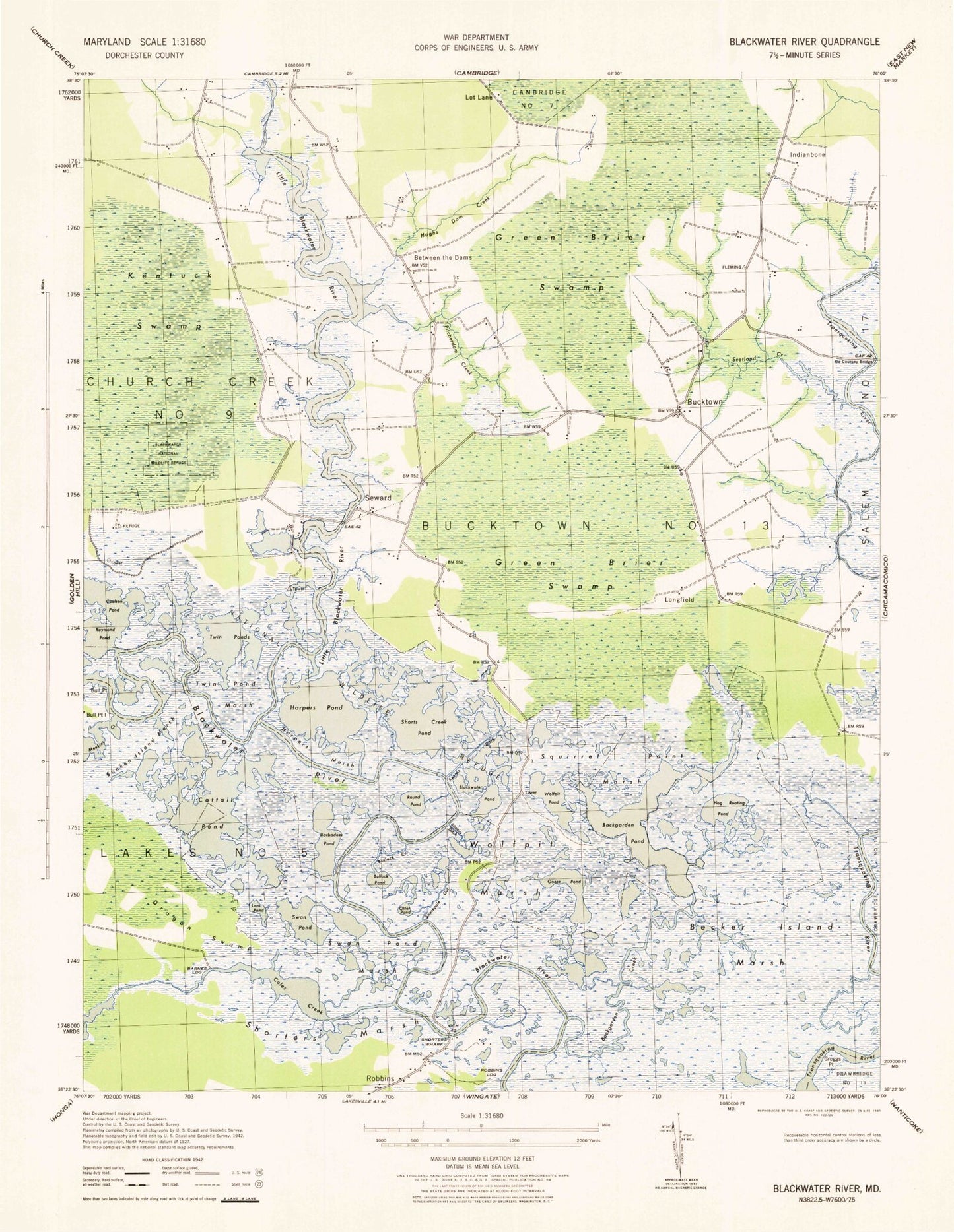
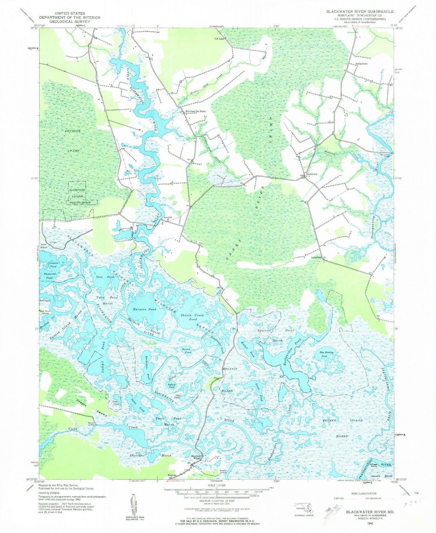
Classic USGS Blackwater River Maryland 7.5'x7.5' Topo Map
Couldn't load pickup availability
Historical USGS topographic quad map of Blackwater River in the state of Maryland. Map scale is 1:24000. Print size is approximately 24" x 27"
This quadrangle is in the following counties: Dorchester.
The map contains contour lines, roads, rivers, towns, and lakes. Printed on high-quality waterproof paper with UV fade-resistant inks, and shipped rolled.
Contains the following named places: Backgarden Creek, Backgarden Creek, Backgarden Pond, Backgarden Pond, Barbadoes Pond, Barbadoes Pond, Barnes Landing, Barnes Landing, Bazzel Church, Bazzel Church, Becker Island Marsh, Becker Island Marsh, Between the Dams, Between the Dams, Blackwater National Wildlife Refuge, Blackwater National Wildlife Refuge, Blackwater National Wildlife Refuge Center, Blackwater National Wildlife Refuge Center, Blackwater Pond, Blackwater Pond, Bonds Church, Bonds Church, Bucktown, Bucktown, Bull Point, Bull Point, Bull Point Island, Bull Point Island, Bullock Creek, Bullock Creek, Bullock Pond, Bullock Pond, Cattail Pond, Cattail Pond, Coles Creek, Coles Creek, Coulson Pond, Coulson Pond, Dieffenbach Pond, Dieffenbach Pond, District 13 Bucktown, District 13 Bucktown, Dorchester County, Dorchester County, Dragon Swamp, Dragon Swamp, Goose Pond, Goose Pond, Green Brier Swamp, Green Brier Swamp, Groggs Point, Groggs Point, Guinea Marsh, Guinea Marsh, Harpers Marsh, Harpers Marsh, Harpers Pond, Harpers Pond, Hog Rooting Pond, Hog Rooting Pond, Hughs Dam Creek, Hughs Dam Creek, Indianbone, Indianbone, Insley Family Cemetery, Insley Family Cemetery, Insleys Point, Insleys Point, Keenes Ditch, Keenes Ditch, Kentuck Swamp, Kentuck Swamp, Kuehnle Pond, Kuehnle Pond, Lans Pond, Lans Pond, Little Blackwater River, Little Blackwater River, Longfield, Longfield, Lot Lane, Lot Lane, Otter Pond, Otter Pond, Pitcher Dam Creek, Pitcher Dam Creek, Raymond Pond, Raymond Pond, Robbins, Robbins, Robbins Landing, Robbins Landing, Round Pond, Round Pond, Scotland Creek, Scotland Creek, Scotts Chapel, Scotts Chapel, Scotts Chapel Cemetery, Scotts Chapel Cemetery, Seward, Seward, Shorters Marsh, Shorters Marsh, Shorters Wharf, Shorters Wharf, Shorts Creek Pond, Shorts Creek Pond, Simons Ditch, Simons Ditch, Snarepole Gut, Snarepole Gut, Squirrel Point Marsh, Squirrel Point Marsh, Sunken Island Marsh, Sunken Island Marsh, Swan Pond, Swan Pond, Swan Pond Marsh, Swan Pond Marsh, Twin Pond Marsh, Twin Pond Marsh, Twin Ponds, Twin Ponds, Wolfpit Marsh, Wolfpit Marsh, Wolfpit Pond, Wolfpit Pond