MyTopo
Classic USGS Canyon Village Wyoming 7.5'x7.5' Topo Map
Couldn't load pickup availability
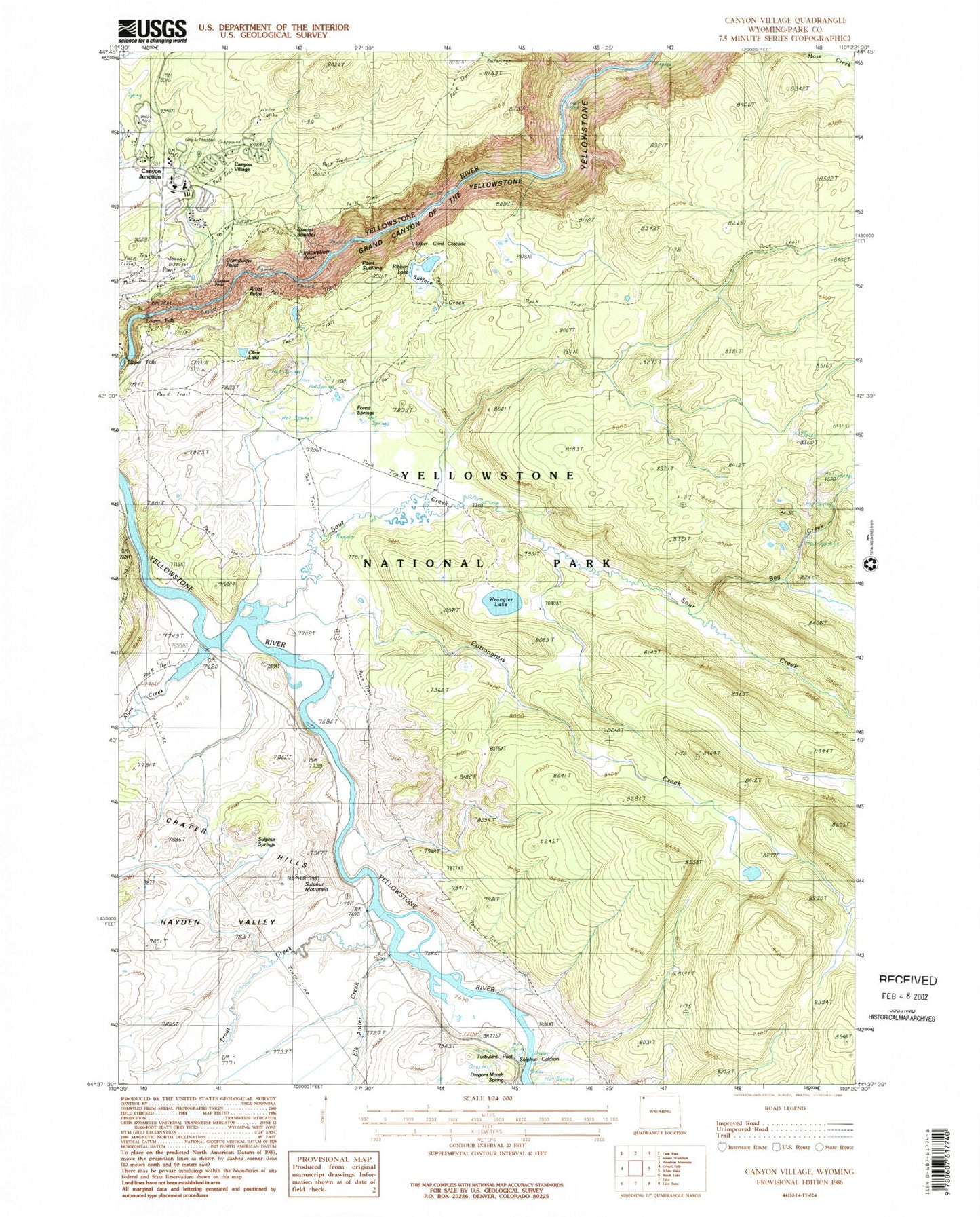
Historical USGS topographic quad map of Canyon Village in the state of Wyoming. Typical map scale is 1:24,000, but may vary for certain years, if available. Print size: 24" x 27"
This quadrangle is in the following counties: Park.
The map contains contour lines, roads, rivers, towns, and lakes. Printed on high-quality waterproof paper with UV fade-resistant inks, and shipped rolled.
Contains the following named places: Alum Creek, Artist Point, Bog Creek, Cascade Creek, Clear Lake, Cottongrass Creek, Crater Hills, Elk Antler Creek, Forest Springs, Glacial Boulder, Glacial Boulder Trail, Hayden Valley, Point Sublime, Ribbon Lake Trail, Sour Creek, Sour Creek Trail, Surface Creek, Trout Creek, Upper Falls of the Yellowstone River, Wrangler Lake, Grand View, Canyon Junction, Canyon Village, Mud Pots, Ribbon Lake, Lower Falls of the Yellowstone River, Dragons Mouth Spring, Inspiration Point, Silver Cord Cascade, Sulphur Caldron, Sulphur Mountain, Red Rock, Lookout Point, Sulphur Spring, Turbulent Pool, Yellowstone National Park Division, Yellowstone National Park Fire Department Canyon Station