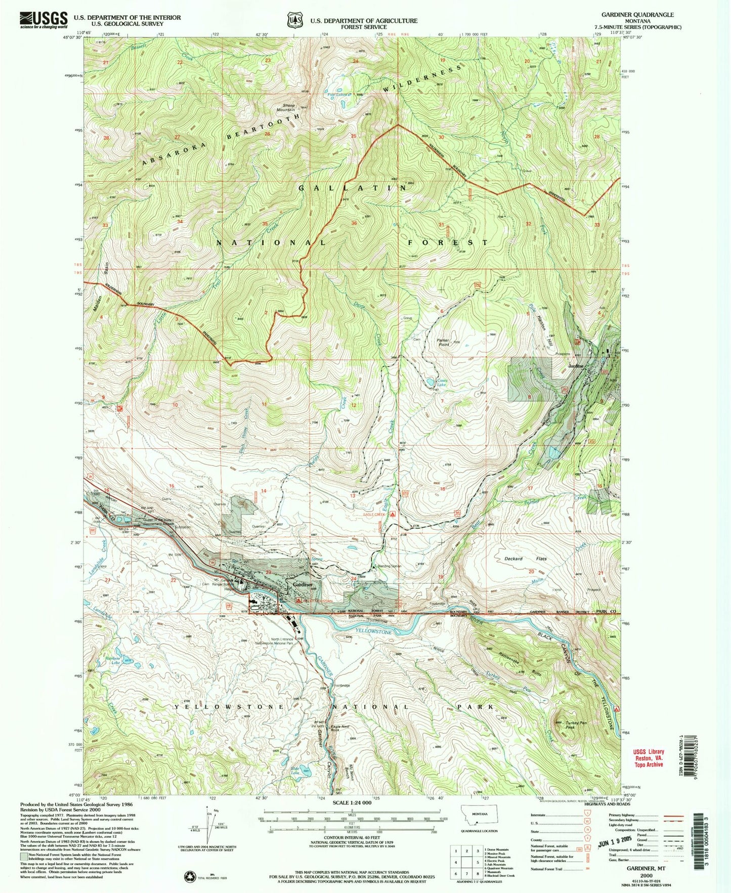
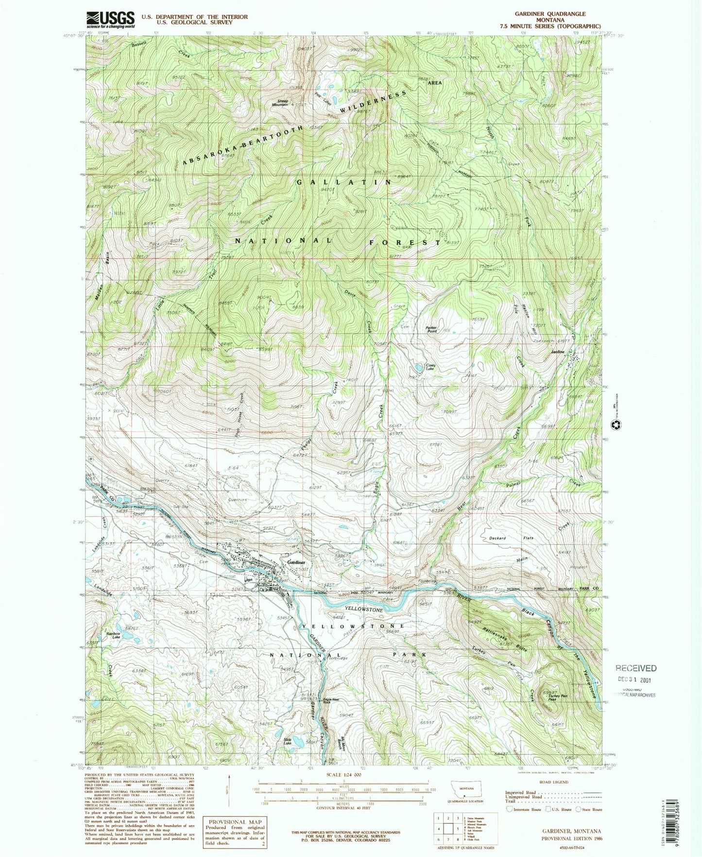
MyTopo
Classic USGS Gardiner Montana 7.5'x7.5' Topo Map
Couldn't load pickup availability
Historical USGS topographic quad map of Gardiner in the state of Montana. Typical map scale is 1:24,000, but may vary for certain years, if available. Print size: 24" x 27"
This quadrangle is in the following counties: Park.
The map contains contour lines, roads, rivers, towns, and lakes. Printed on high-quality waterproof paper with UV fade-resistant inks, and shipped rolled.
Contains the following named places: Bear Creek, Blanding Station, Casey Lake, Deckard Flats, Five Lakes, Gardiner, Jardine, North Fork Bear Creek, Palmer Creek, Parker Point, Pine Creek, Pole Creek, Sheep Mountain, Eagle Creek Recreation Site, Black Canyon of the Yellowstone, Eagle Creek, Eagle Nest Rock, Gardner River, Landslide Creek, McMinn Bench, North Entrance Yellowstone National Park, Phelps Creek, Rainbow Lake, Rattlesnake Butte, Rescue Creek Trail, Slide Lake, Turkey Pen Peak, Queen of the Waters Sportsmans Access, Hanlon Hill, Turkey Pen Creek, Malin Creek, Shaft House Creek, Davis Creek, Gardiner Airport, Maiden Basin, 09s08e23ddcb01 Well, Gardner Canyon, Rocky Mountain Campground, Yellowstone River Bridge, Gardiner Cemetery, Rocky Mountain Trailer Park, Gardiner Community Library, Calamity Janes Trailer Court, Gardiner Baptist Church, The Church of Jesus Christ of Latter Day Saints, Gardiner Community Church, Saint Williams Catholic Church, Gardiner Post Office, Gardiner (historical), Gardiner School, Jardine School (historical), Jardine Post Office (historical), Deever (historical), Gardiner Community Park, Gateway Hose Company, Gardiner Census Designated Place, Park County Sheriff's Office Substation