
MyTopo
Adam Peak Nevada US Topo Map
Couldn't load pickup availability
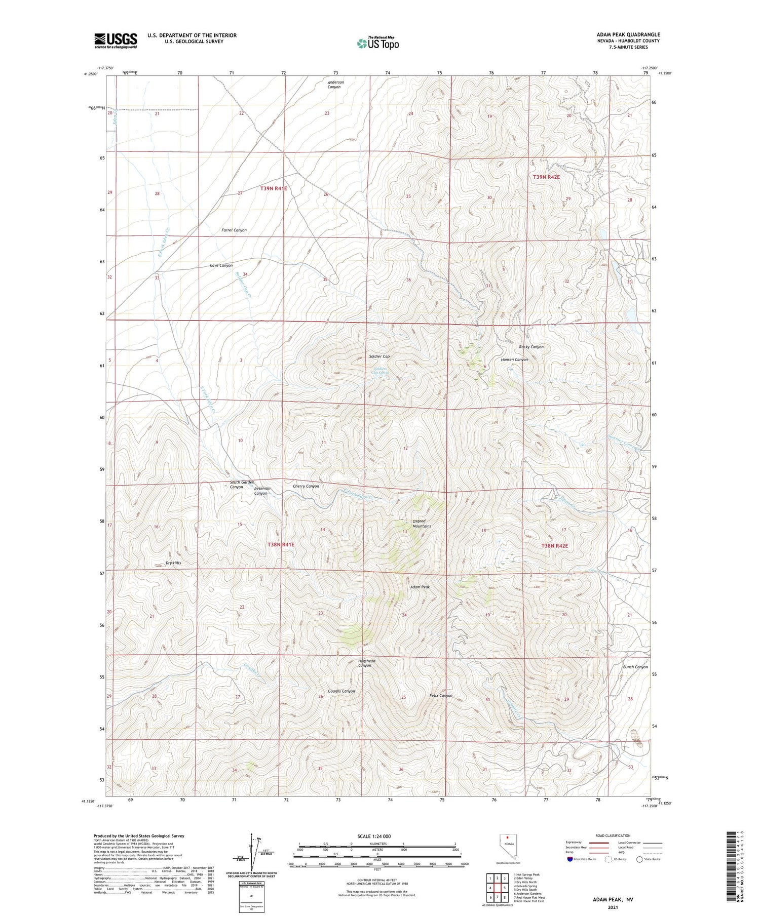
2021 topographic map quadrangle Adam Peak in the state of Nevada. Scale: 1:24000. Based on the newly updated USGS 7.5' US Topo map series, this map is in the following counties: Humboldt. The map contains contour data, water features, and other items you are used to seeing on USGS maps, but also has updated roads and other features. This is the next generation of topographic maps. Printed on high-quality waterproof paper with UV fade-resistant inks.
Quads adjacent to this one:
West: Delvada Spring
Northwest: Hot Springs Peak
North: Eden Valley
Northeast: Dry Hills North
East: Dry Hills South
Southeast: Red House Flat East
South: Red House Flat West
Southwest: Anderson Gardens
Contains the following named places: Adam Peak, Alpine Mine, Anderson Canyon, Bunch Canyon, Cave Canyon, Cherry Canyon, Clover Valley School, Dry Creek, Dry Hills, East Fork Eden Creek, Farrel Canyon, Getchell, Getchell Mine, Getchell Section Five Pit, Granite Creek Mine, Kirby Mine, Marcus Mine, Mountain King Mine, Pacific Mine, Penson Ranch, Pinson Mine, Pinson Mining Company Landing Strip, Potosi-Getchell Mining District, Reilly Mine, Reservoir Canyon, Richmond Mine, Soldier Cap, Soldier Cap Creek, Soldiers Cap Spring, South Garden Canyon, Stone House, T N T Mine, Tip Top Mine, Tonopah Mine, Top Row Mine, Valley View Mine, Yribarne Ranch


