MyTopo
Adobe Downs Ranch New Mexico US Topo Map
Couldn't load pickup availability
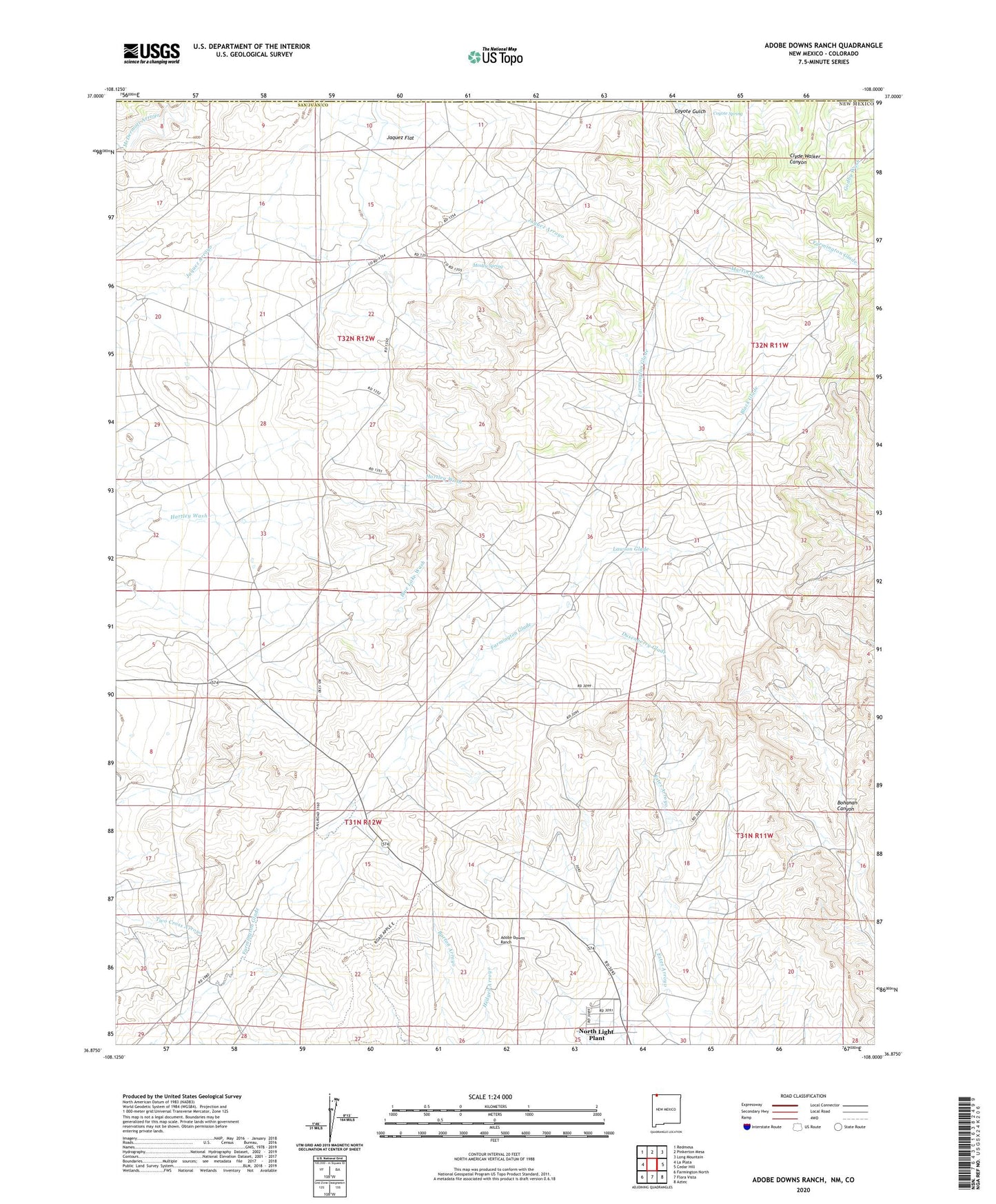
2020 topographic map quadrangle Adobe Downs Ranch in the state of New Mexico. Scale: 1:24000. Based on the newly updated USGS 7.5' US Topo map series, this map is in the following counties: San Juan, La Plata. The map contains contour data, water features, and other items you are used to seeing on USGS maps, but also has updated roads and other features. This is the next generation of topographic maps. Printed on high-quality waterproof paper with UV fade-resistant inks.
Quads adjacent to this one:
West: La Plata
Northwest: Redmesa
North: Pinkerton Mesa
Northeast: Long Mountain
East: Cedar Hill
Southeast: Aztec
South: Flora Vista
Southwest: Farmington North
Contains the following named places: Adobe Downs Ranch, Black Glade, Camel Hump Dam, Coyote Spring, Drip Pee Wee Dam, Dusenberry Glade, Hedges North Dam, Jaquez Flat, Knob Rock Dam, Lawson Glade, Martin Glade, McDermott Ditch, Mosley Spring, New Mexico Mine, Oliver Dike, Painted Hills Dam, Pee Wee Dam, Vee Dam, White Hill Dam, Wilson Ranch, Zebra Hills Dam