MyTopo
Atkinson North Carolina US Topo Map
Couldn't load pickup availability
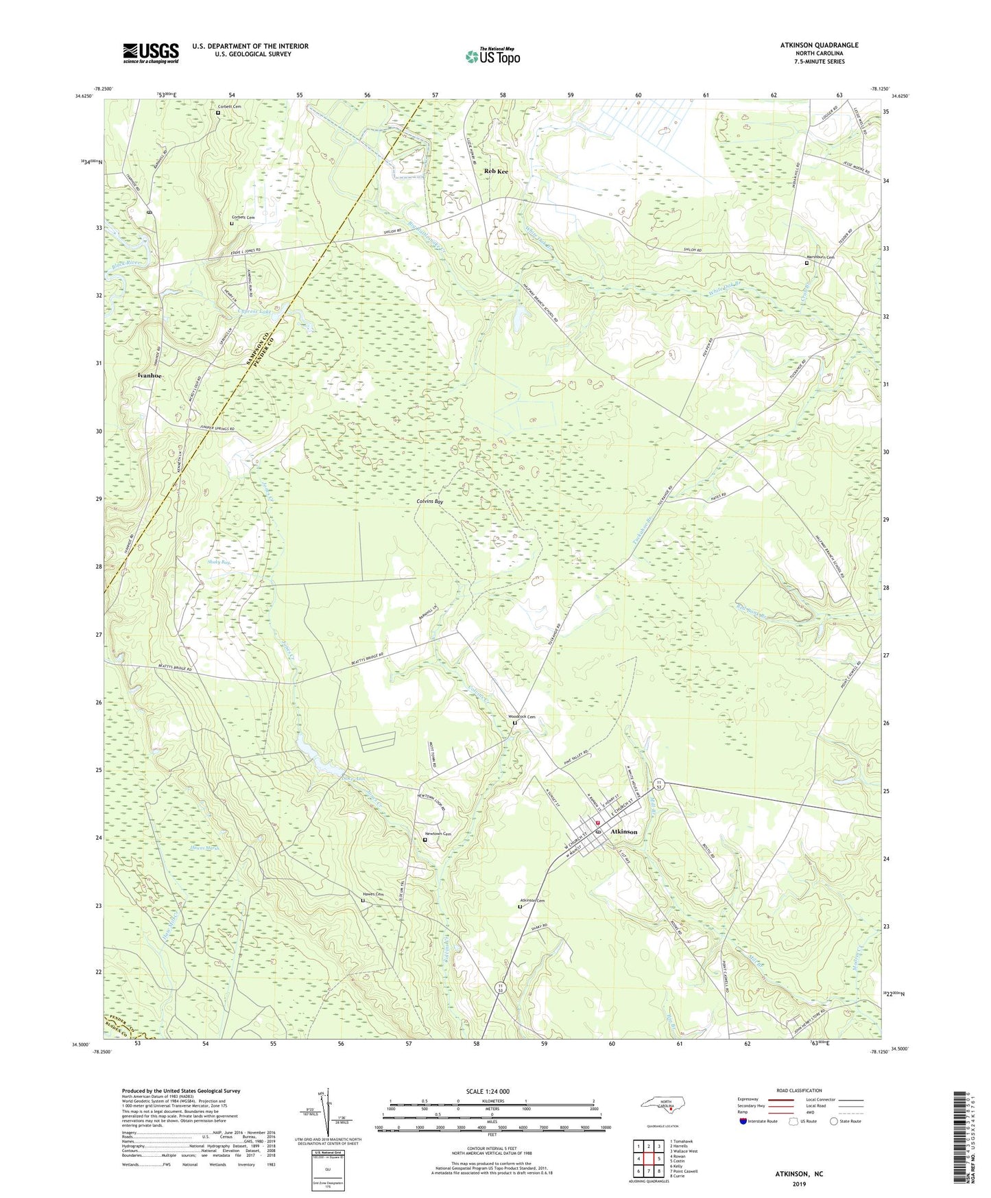
2019 topographic map quadrangle Atkinson in the state of North Carolina. Scale: 1:24000. Based on the newly updated USGS 7.5' US Topo map series, this map is in the following counties: Pender, Sampson, Bladen. The map contains contour data, water features, and other items you are used to seeing on USGS maps, but also has updated roads and other features. This is the next generation of topographic maps. Printed on high-quality waterproof paper with UV fade-resistant inks.
Quads adjacent to this one:
West: Rowan
Northwest: Tomahawk
North: Harrells
Northeast: Wallace West
East: Costin
Southeast: Currie
South: Point Caswell
Southwest: Kelly
Contains the following named places: Atkinson, Atkinson Cemetery, Atkinson Fire Department, Atkinson Middle School, Atkinson Post Office, Atkinson School, Big Rattlesnake Creek, Black River Presbyterian Church, Colvins Bay, Corbett Cemetery, Crab Branch, Cypress Lake, Halfway Branch School, Hawes Cemetery, Hawes Chapel, Hawes Marsh, Ivanhoe, Ivanhoe Census Designated Place, Ivanhoe Post Office, Jones Creek, Lake Ann, Marshburn Cemetery, Mill Branch, Mill Creek, New Zion Church, Newtown Cemetery, Reb Kee, Saint Marys Church, Shaky Bay, Town of Atkinson, Township of Caswell, Tuckahoe Branch, Woodcock Cemetery, ZIP Code: 28421