MyTopo
Amesville Ohio US Topo Map
Couldn't load pickup availability
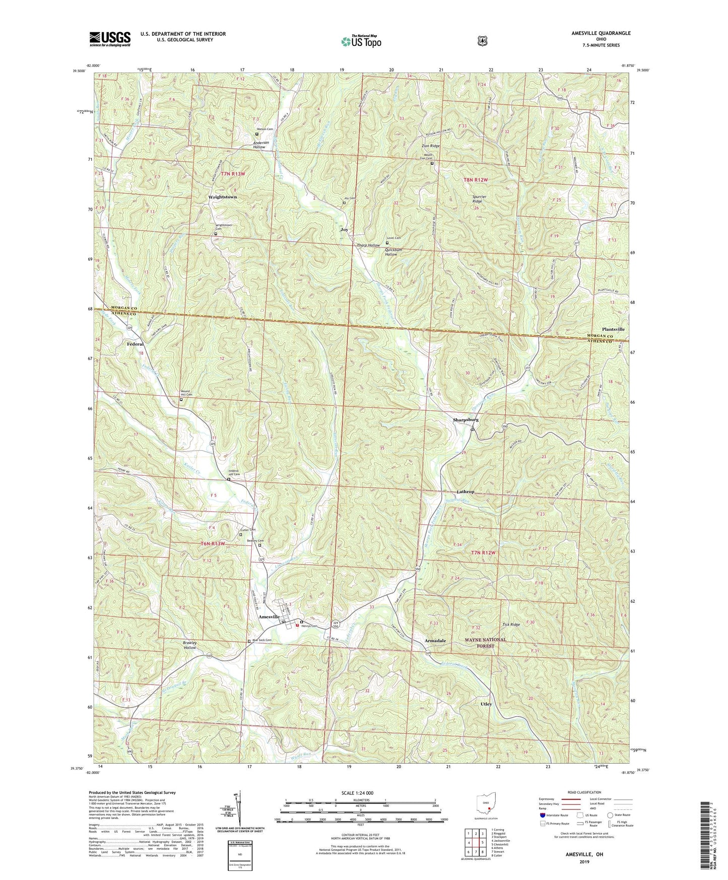
2019 topographic map quadrangle Amesville in the state of Ohio. Scale: 1:24000. Based on the newly updated USGS 7.5' US Topo map series, this map is in the following counties: Athens, Morgan. The map contains contour data, water features, and other items you are used to seeing on USGS maps, but also has updated roads and other features. This is the next generation of topographic maps. Printed on high-quality waterproof paper with UV fade-resistant inks.
Quads adjacent to this one:
West: Jacksonville
Northwest: Corning
North: Ringgold
Northeast: Stockport
East: Chesterhill
Southeast: Cutler
South: Stewart
Southwest: Athens
Contains the following named places: Amesville, Amesville Ames - Bern Township Volunteer Fire Department, Amesville Elementary School, Amesville Post Office, Anderson Hollow, Armadale, Armdale Post Office, Beasley Cemetery, Brawley Hollow, Curtis Junction, Cutler Cemetery, Drapers Run, Ewing Run, Federal, Federal Hill Cemetery, Federal Valley Church, Gifford State Forest, Henrys Cemetery, Hyde Fork, Joy, Joy Cemetery, Joy Christian Church, Joy Methodist Episcopal Church, Joy Post Office, Joy Run, Kasler Creek, Kitten Run, Lathrop, Linscott Run, Lovel Cemetery, McDougall Branch, McElfresh Run, Miners Fork, Mound Hill Cemetery, Mound Hill Church, Mount Carmel Church, Mount Zion Bible Christian Church, Mount Zion Cemetery, Mud Sock Cemetery, Mush Run, Opossum Run, Plantsville, Plantsville Post Office, Quickbum Hollow, Sharps Fork Federal Creek, Sharpsburg, Sharpsburg Post Office, Smith Run, Spurrier Ridge, Starling Run, Sulphur Run, Tharp Hollow, Tick Ridge, Township of Bern, Township of Marion, Utley, Utley Post Office, Village of Amesville, Watson Cemetery, Wrightstown, Wrightstown Cemetery, Wrightsville Bible Christian Church, Wyatt Run, Zion Ridge, ZIP Codes: 43728, 45711