MyTopo
Agar South Dakota US Topo Map
Couldn't load pickup availability
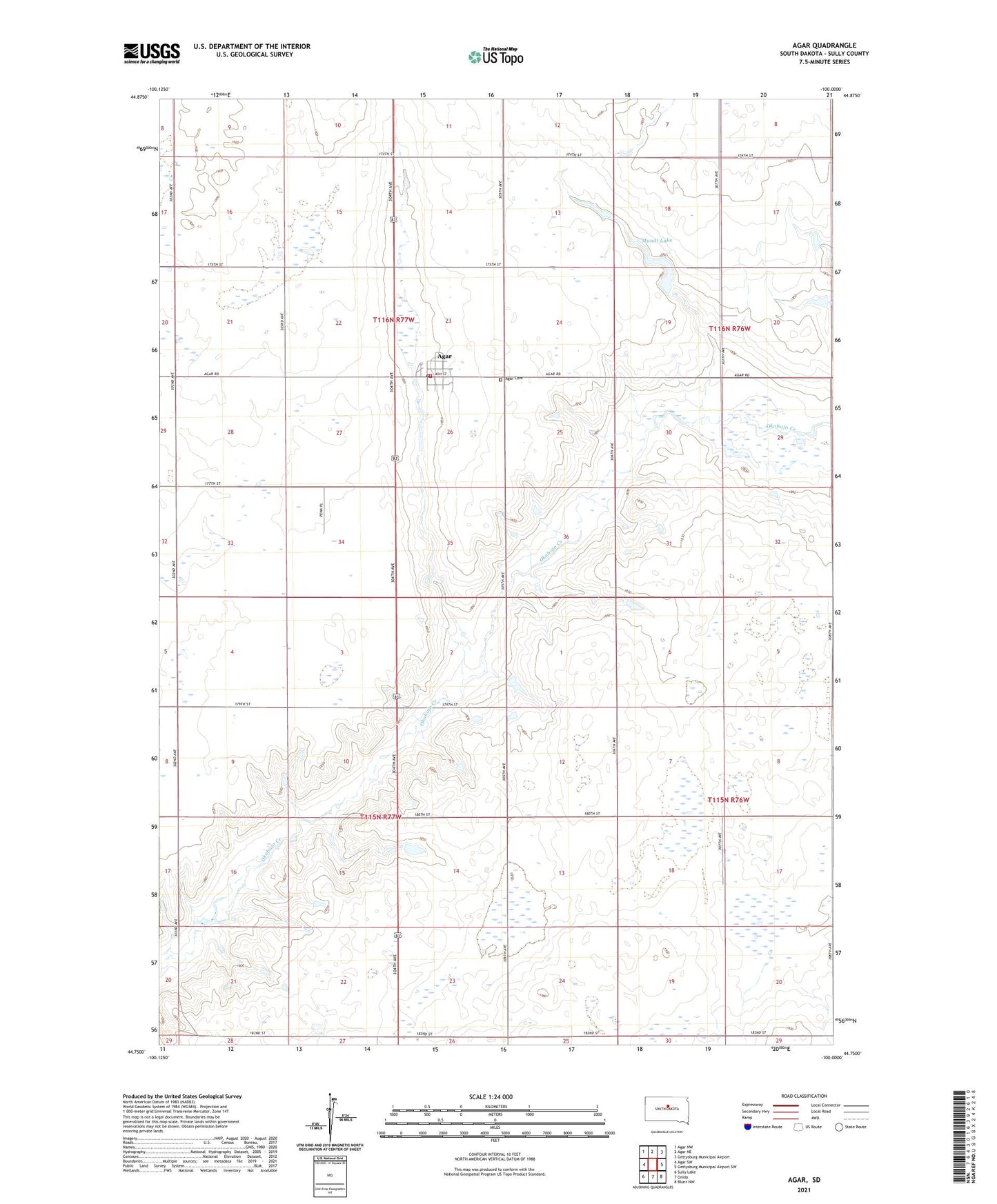
2021 topographic map quadrangle Agar in the state of South Dakota. Scale: 1:24000. Based on the newly updated USGS 7.5' US Topo map series, this map is in the following counties: Sully. The map contains contour data, water features, and other items you are used to seeing on USGS maps, but also has updated roads and other features. This is the next generation of topographic maps. Printed on high-quality waterproof paper with UV fade-resistant inks.
Quads adjacent to this one:
West: Agar SW
Northwest: Agar NW
North: Agar NE
Northeast: Gettysburg Municipal Airport
East: Gettysburg Municipal Airport SW
Southeast: Blunt NW
South: Onida
Southwest: Sully Lake
Contains the following named places: Agar, Agar Cemetery, Agar Post Office, Agar Volunteer Fire Department, Harrison School, Milford Post Office, Mundt Lake, Town of Agar, Township of Garner, Township of Milford, Waterford